Loughborough Road, Swannington
To try and confuse people, Loughborough Road has a Coleorton postal address. The Swannington and Coleorton parish boundary is the back gardens of the houses on the north side of Loughborough Road. The A512 Loughborough Road used to be the Ashby to Loughborough turnpike road and had several toll booths along its length.
Historical researchers can also be confused by the absence of the name Loughborough Road, as it has only been in use since the Second World War (or later?). They will find Loughborough Road properties listed under the generic name St George’s Hill, an area encompassing current day:
- St George’s Hill
- Top of Church Hill (also known as Snape Hill or The Snapes)
- Loughborough Road
- South part of New Road
- South part of Nottingham Road
The Peggs Green Island (or roundabout for non Leicestershire people) replaced the crossroads in the 1950s.
Peggs Green Island to Boundary with Thringstone – North Side
Mee’s Blacksmith’s Forge
Prior to the construction of a roundabout in Loughborough Road (1960s?) it was a crossroads. Just to the north of the junction with Nottingham Road was Mee’s blacksmith’s forge.
The Leicester Advertiser of the 21st February 1964 reported
At Peggs Green at the Loughborough Road junction with Coleorton, brothers Jack and Edgar Mee had to move house when a roundabout “annihilated” their old smithy.
But in their new home they still carry on the tradition of four generations – Edgar as the shoeing expert and Jack handling the agricultural machinery side.
 Mee's blacksmith forge near what is now Peggs Green island.
 Mee's smithy near the junction of Loughborough Road and Nottingham Road.
Redhall Garage
Redhall garage has many decades of serving the Swannington and district community. It used to incorporate a sub post office, which became a shop supplying a few basics to customers fuelling their cars with petrol. It was the last garage in Swannington to serve petrol. The cost of renewing pumps and competition from supermarkets led to the garage ceasing to sell petrol in 2017.
The garage ceasing to sell petrol is a reminder that Swannington is continually changing and the importance of recording these changes before they are forgotten. The Trust welcomes information and photographs of changes to shops, houses, farms and other buildings whether recent or many decades ago.
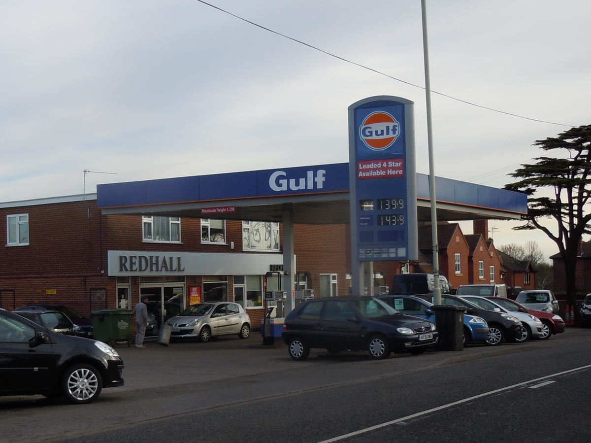 Redhall garage selling petrol 2012
 Gulf & Standard Oil formed Chevron 1985
 Petrol pumps being removed 8th August 2017
 Petrol pumps being removed 8th August 2017
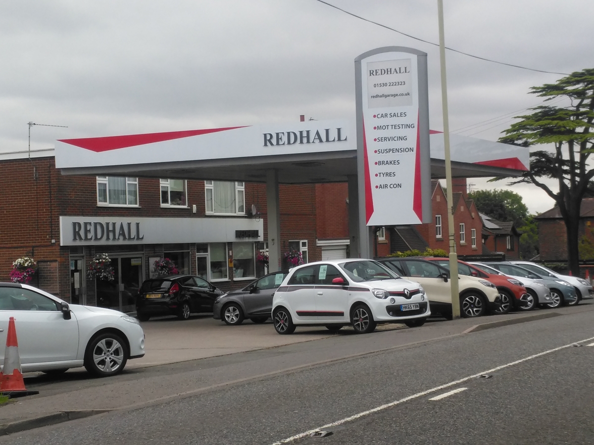 New look to the garage 21st August 2017
Anchor Inn
The Anchor Inn on the corner of Anchor Lane and Loughborough Road and the Swannington and Thringstone boundary ran behind it.
 Anchor Inn, corner of Anchor Lane and Loughborough Road, 1903 map
Peggs Green Island to Boundary with Thringstone – South Side
Swannington Vicarage
A few years after St George’s Church opened in 1827 a house was built for the curate in charge. When St George’s ceased to be part of Whitwick parish in 1875, the house became the vicarage. It is a large house, the 1911 census recording it as having 12 rooms at a time when the typical Swannington house had four rooms.
The vicars often had large families and one or two live-in servants. During the 19th century a vicar ran a small day school from the vicarage.
Despite its out of the way location, the vicarage was used for social events:
Ashby-de-la-Zouch Gazette – Saturday 30 May 1885 – SWANNINGTON – ODDFELLOWS DEMONSTRATION – On Whit- Monday, the members of the Leicestershire Seraphic Order of Oddfellows met at their lodge.house, Mr. John Baseley’s, Station Inn, to celebrate their annual festival.
After transacting the usual business the members formed in procession for church, headed by the Ashby Volunteer Band. At the church a most excellent sermon was preached by the Rev. F. T. Pearson, from the 11th chapter of Genesis, part of the 6th verse, and it was very attentively listened to. The service being over, the members wended their way to the vicarage, the band playing an excellent selection of music. After the bandsmen had been refreshed, the procession marched towards the lodge-house, the day being rather unfavourable for the festival.
Views of Thringstone and Whitwick
Between the vicarage and St George’s Lodge there are some wonderful views of Thringstone, Whitwick and Cademan Wood.
 View of Thringstone, Whitwick and Cademan Wood from opposite Anchor Lane - by David Harms, Whitwick u3a
St George’s Lodge
On the opposite side of the road from Redhall Garage is St George’s Lodge, built on land once occupied by the surgeon Richard Orton in 1859.
Local historian and parish councillor Herbert Butler Johnson lived there around 1900.
Frances Robinson the landlady of the Fountain Inn retired there in 1936 and the house was still occupied by the family until at least 1989.
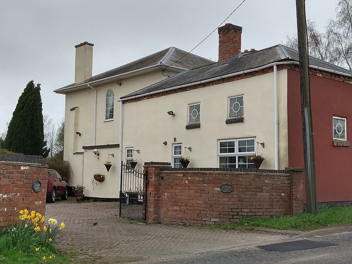 St George's Lodge, Loughborough Road 2021
St George’s Church
Originally named St George’s Whitwick as in 1827 it was a chapel of ease within the parish of Whitwick, even though the church became a parish in its own right in 1875, the name remained until the 1920s or 1930s.
St George’s Church became a listed building in 1983.
 St George's Church, Loughborough Road 2021 - by David Harms, Whitwick u3a
Kirby’s Post Mill
Thomas and Mahala Kirby lived on the corner of Loughborough Road and New Road. They had a short walk across the road to their post mill. They died in 1891 and it is understood the post mill was sold in 1894.
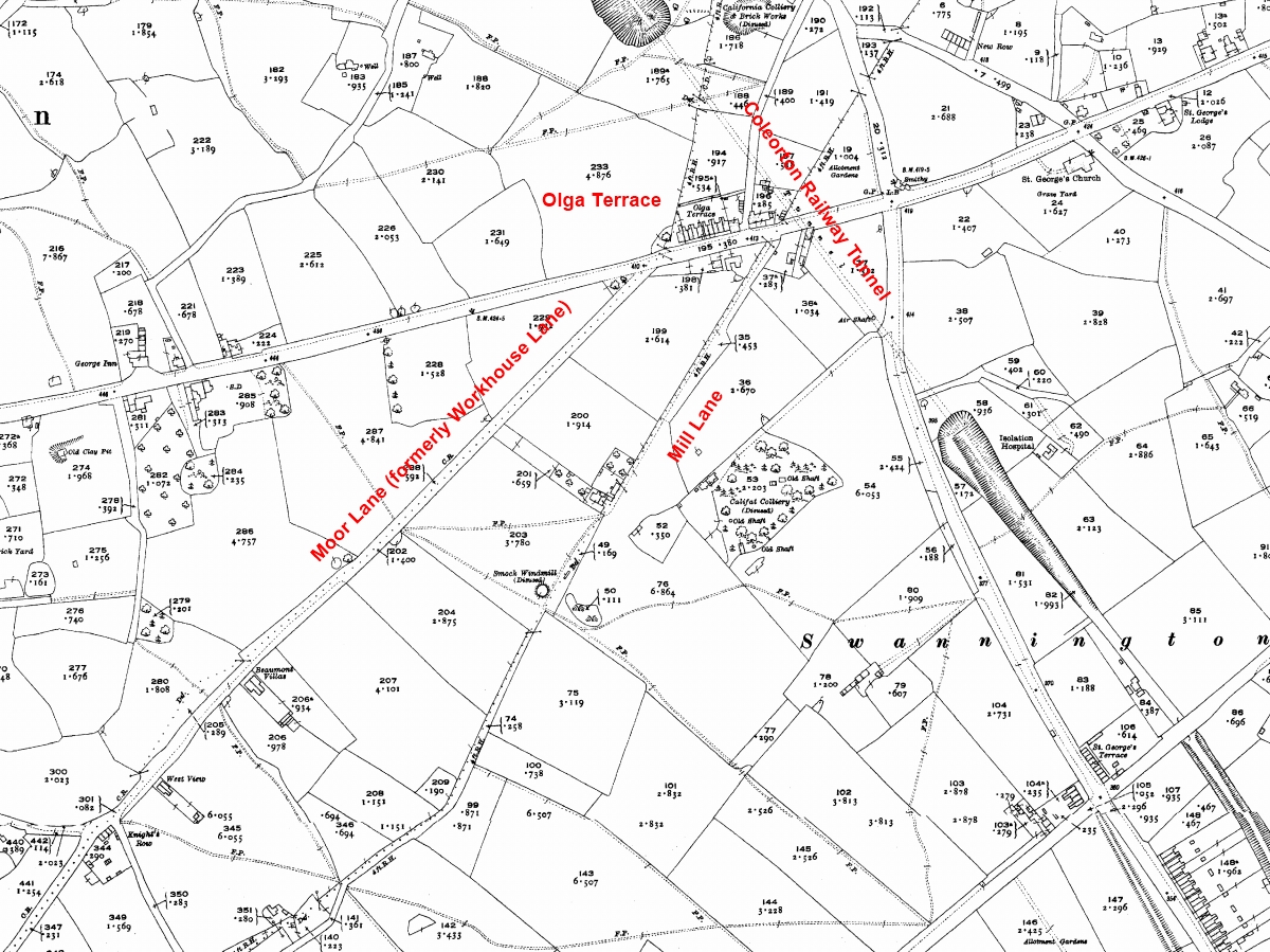
 1962 Ordnance Survey Map Loughborough Road + St George's Hill with parish boundaries - red to 31 March 1936, green from 1 April 1936
Peggs Green Island to Boundary with Coleorton – South Side
Between the roundabout and Mill Lane, Loughborough Road passes over the former Coleorton Railway tunnel, but there is not any visible evidence.
To the south there are good views of Hough Mill across the fields and along Mill Lane
Until 1936 part of Loughborough Road was in Thringstone parish. The Thringstone finger went down Mill Lane, passed the windmill to the boundary with Coleorton at the west end of The Rowlands, returning via Workhouse Lane (which after the Second World War changed its name to Moor Lane).
 Loughborough Road 1923 Ordnance Survey Map
Dr Parker’s House
Visitors to Hough Mill regularly ask about the white art deco house on Loughborough Road that is very visible from the mill. The house does not appear on the 1923 map, but was occupied by Dr Parker in 1939 when the residents were:
- Christopher Stanley Parker, born 1889, general medical practitioner
- Alice Laura Winifred Parker, born 1889, unpaid domestic duties
- Janet Parker, born 1921, unpaid domestic duties
- Geoffrey Parker, born 1923, at school
 Dr Parker's art deco white house in Loughborough Road - view from Hough Mill - by Bill Pemberton
Peggs Green Island to Boundary with Coleorton – North Side
Circle Garage
The Circle Garage does not appear on the 1923 map, but is on the 1962 map.
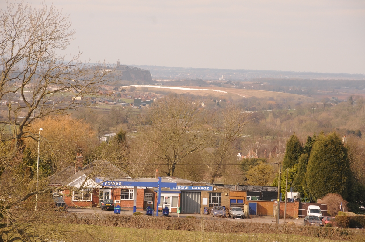 Circle garage from Hough Mill, Newbold pipe works in distance, 2014 - by Bill Pemberton
 Circle garage 2012 when still selling petrol
Olga Terrace
Olga Terrace was part of Thringstone until the 1st April 1936 when it transferred into Swannington parish.
It is understood that the bricks were made in the California brickyard in nearby Zion Hill and wheel barrowed along Tugby’s Lane to Loughborough Road.
The terraced row of houses known as Olga Terrace does not appear on the 1883 map but is listed on the 1903 map. The terrace has not been found on the 1891 census but appears on the 1901 census.
The first documentary evidence of Olga Terrace is the 15th April 1899 Leicester Chronicle report on the bankruptcy of Arthur Bishop, general dealer of Olga Terrace. He had moved there from Swannington in March 1897.
It was believed that the terrace was named after the builder’s wife Olga Devy, but research has shown the story is not quite accurate. MARY OLGA IRIS DEVY was born on the 19th November 1895 at Ashby Road, Thringstone. Her parents were Samuel Devy, a brick manufacturer, and Sarah Ann Devy, formerly Murrell. It is thus probable that Samuel owned or operated the California brickyard. The Devy family emigrated to Victoria, Australia and lived in “Coleorton”, Union Street, Malvern. Mary Olga married George William Sibbin in 1917, had a daughter Pat and died at Caulfield, Victoria, Australia in 1969.
1901 Census
See the inhabitants recorded on the 1901 census Olga Terrace.
Olga Terrace Sold 1903
On the 30th July 1903 the Burton Chronicle reported on the sale of valuable freehold property at St George’s Hill Thringstone, by auction at the New Engine Inn, Peggs Green:
- Lot 1 – Dwelling house and shop occupied by Mr. H. Hull, with cart entrance, stable and trap-house with loft over, on the Ashby to Loughborough Road adjoining the lane to Peggs Green.
- Lot 2 – Substantially built row of 10 messuages known as Olga Terrace, all occupied, producing a gross annual rent of £107 12s.
- Lots 3 and 4 – croft and close of old turf land behind lots 1 and 2, occupied by Mr. H. Hull.
1911 Census
At the end of Olga Terrace, on the corner of Tugbys Lane, was Hull’s shop. At the 1911 census Roland Hull was a 15 year old schoolboy, although he would have helped his parents, Herbert and Mary Hull in the shop. By 1939 Roland had taken over from his parents as a grocer and general dealer. Roland lived with his wife Lucy, seven year old daughter Daphne and his widowed mother. Roland was the enumerator for the 1939 register for that area of Swannington. The shop later became a transport cafe. See the inhabitants recorded on the 1911 census Olga Terrace.
1939 Register
See the inhabitants recorded on the 1939 register Olga Terrace.
The Birmingham Daily Post of the 17th November 1939 reported:
Investments at Ashby-de-la-Zouch
Messrs. Stevenson and Barratt, of Ashby-de-la-Zouch, offered by public auction three properties at Swannington. A block of investment properties, Olga Terrace, producing £171 12s. a year gross, or £108 12s. after rates had been paid, was purchased by Dr. Parker for £1,635. A close of grassland of 2 1/4 acres, let at £5 a year, was sold to Mr. Walker of Swannington for £135. An untenanted house was passed.