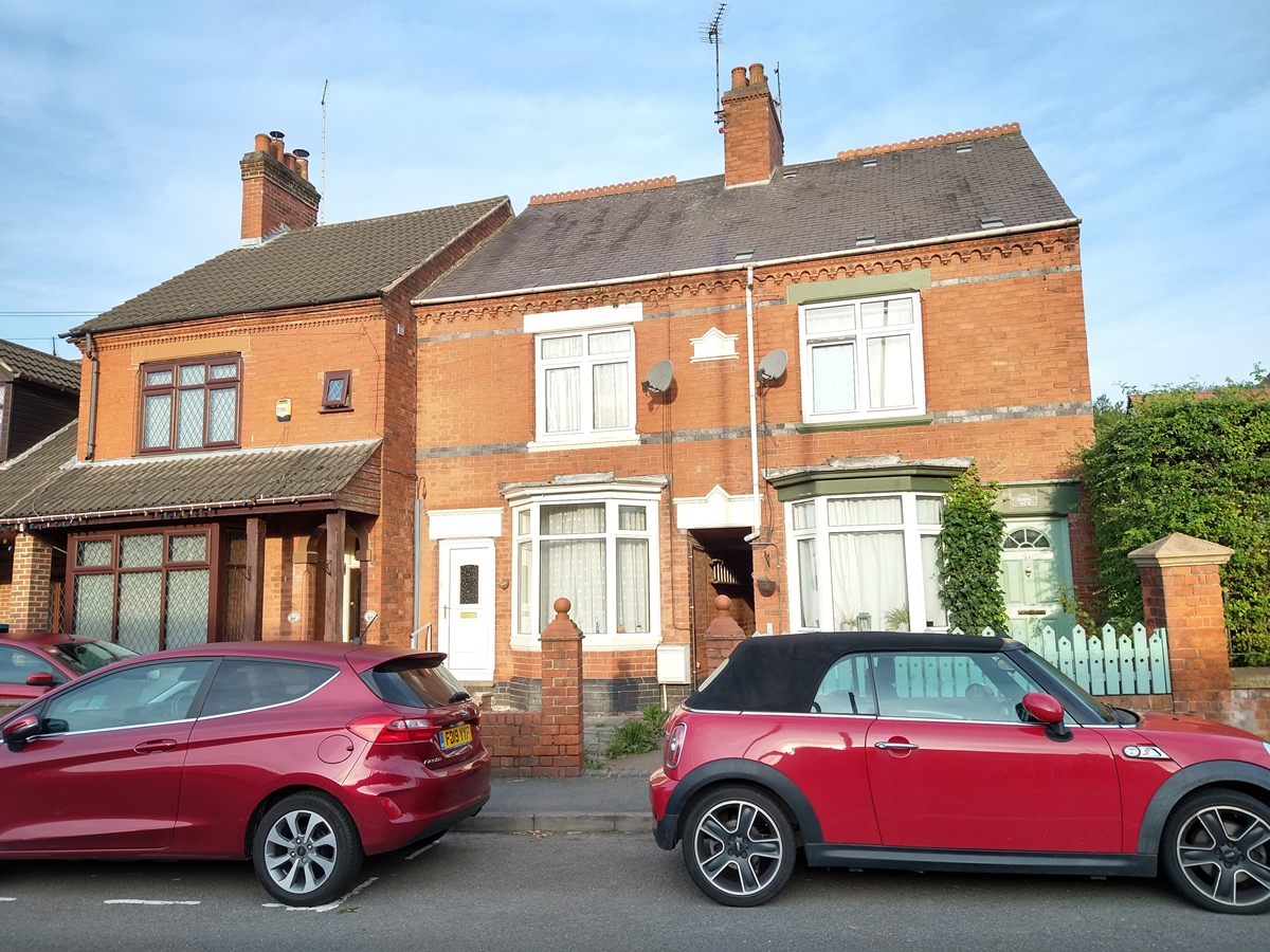
Main Street
Maps
The road from Hoo Ash Island to Peggs Green Island was part of the 18th century Hinckley and Melbourne Turnpike. By the 19th century the section from Spring Lane to Limby Hall Lane was known as Main Street.
Main Street is highlighted on the maps below. Existing features are annotated in blue, new features in red.
In 1760 Main Street became part of the Hinckley to Melbourne turnpike. The Main Street Dash is one of the downloadable village walks on this website. With so many properties in Main Street it has been split into:
- Primitive Methodist Chapel To Centre Farm – East Side – includes former Willow Farm.
- Primitive Methodist Chapel To Centre Farm – West Side – includes Elm Farm.
- School To Burtons Lane East Side – includes former petrol station, village tap, tap house, Quaker Smithy.
- School To Burtons Lane West Side – includes chilli’n’spice, centre cottages, Wesleyan Chapel.
- Burtons Lane To Village Hall – East Side – includes Manor Farm, Railway Inn.
- Burtons Lane To Village Hall – West Side – includes Auntie May’s Cottage, The Firs, Stone House and Bull’s Head.
- Village Hall To Limby Hall Lane East Side – includes The Grove, former Swannington House, Hidden House, Bottom of Incline and Piano Row.
- Village Hall To Limby Hall Lane West Side – includes Hough’s Cottages, Trinders, Fountain Inn, Brook House, Califat Tramway.
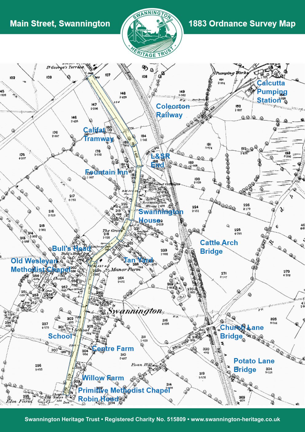
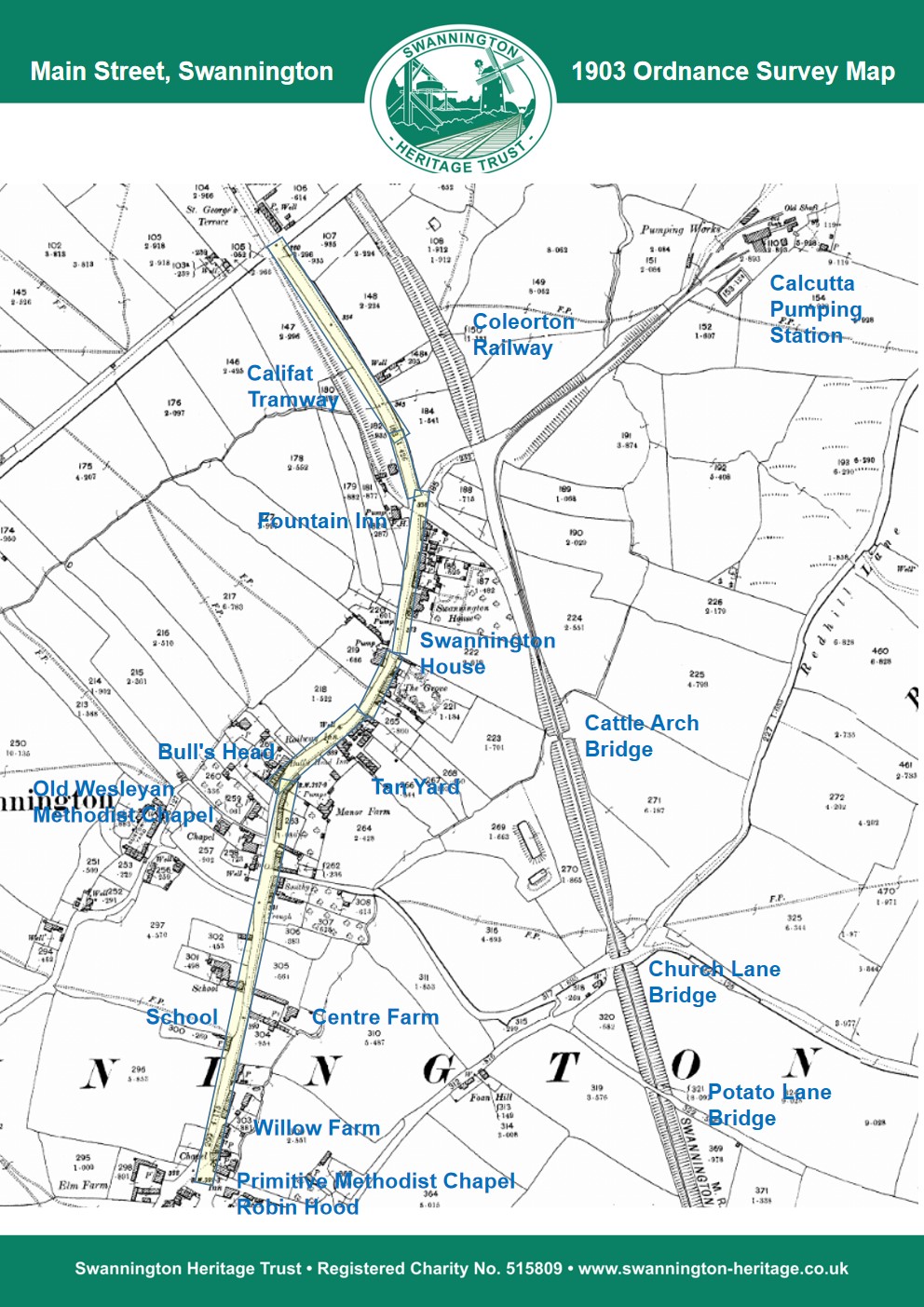
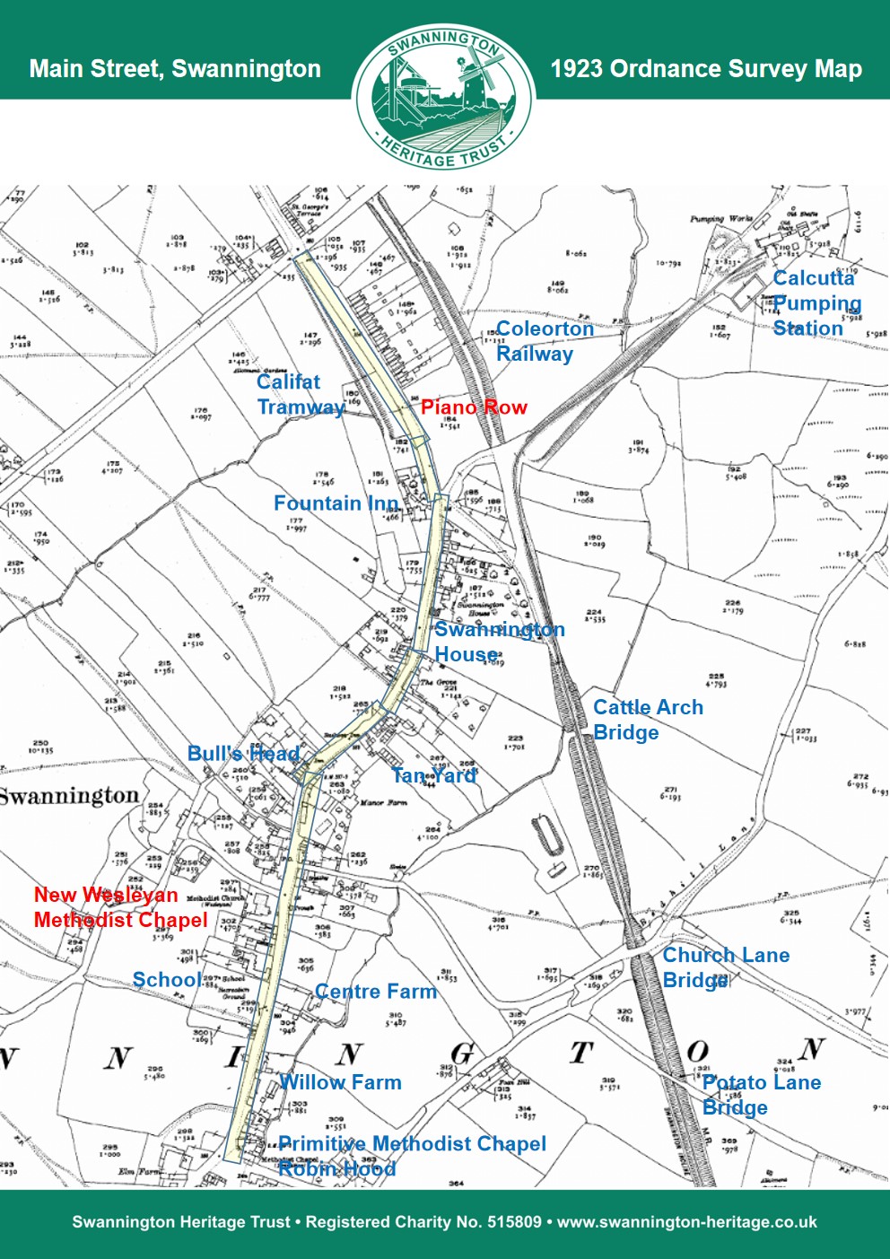
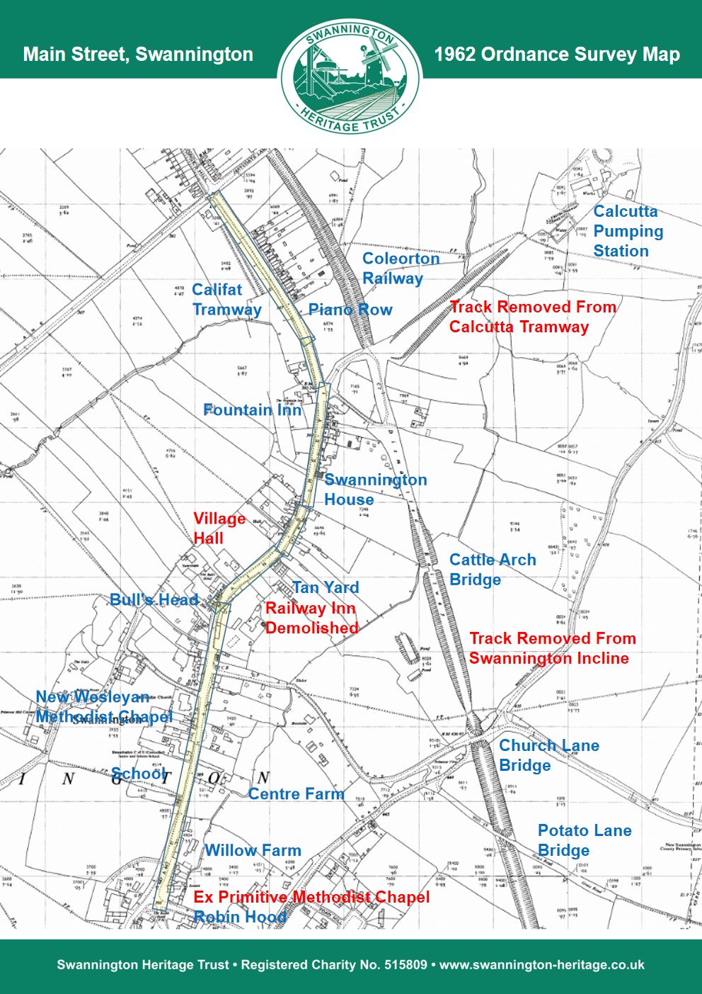

Main Street from south (Coalville and Ravenstone end) to north:
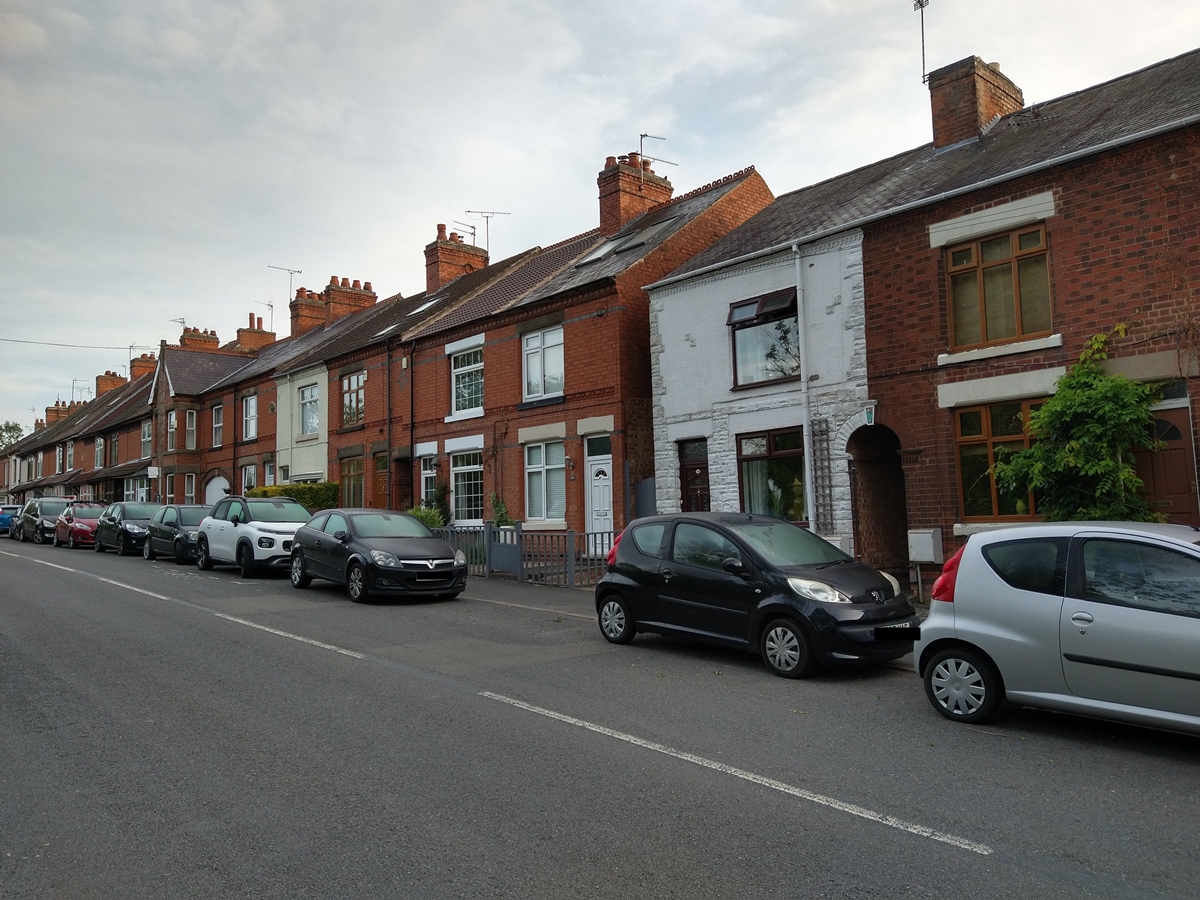
Primitive Methodist Chapel To Centre Farm – East Side
Former Primitive Methodist Chapel – The chapel was built in 1858 and closed in 1956. It became the workshop for Midland Patterns, then after some years without use was converted into two flats. Read more about the Primitive Methodist Chapel.
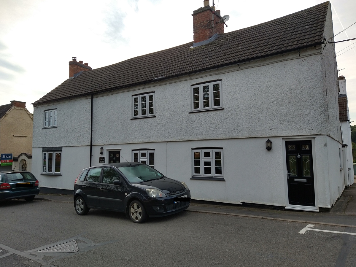
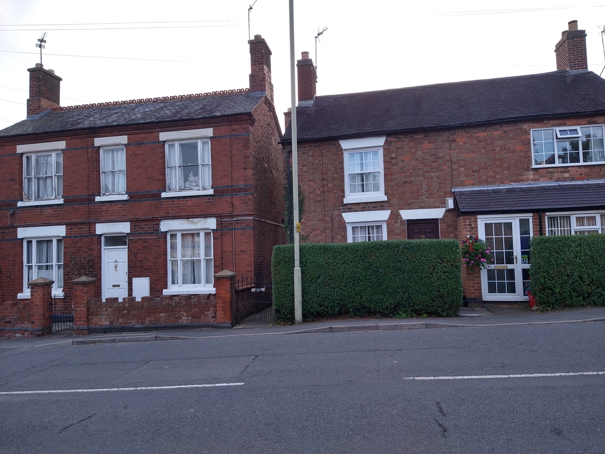
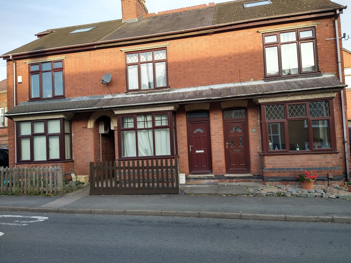
Semi Detached Houses – There are two pairs of 19th century semi-detached houses, one of which used to be a sub post office (there are four former sub post offices in Swannington, three are in Main Street).
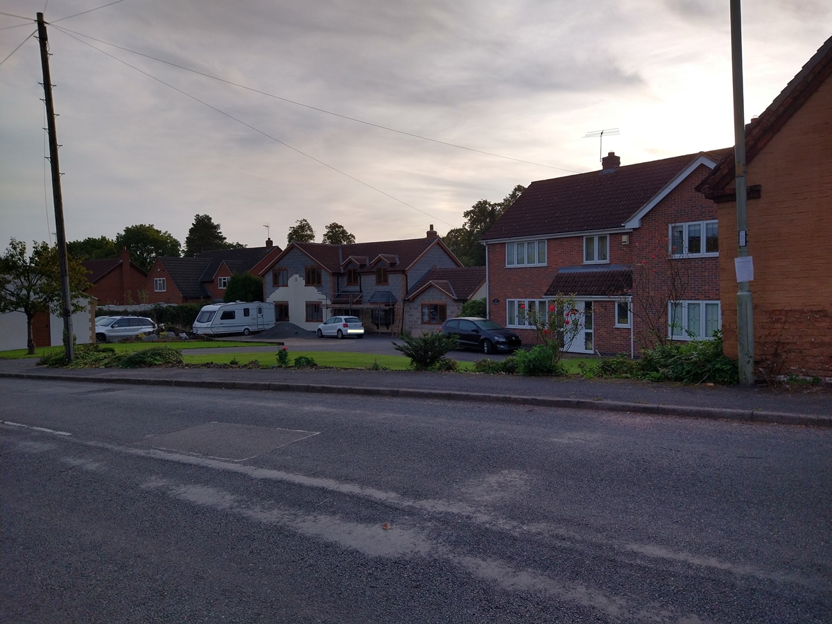
Former Willow Farm – There are now houses and bungalows on the site of the former Willow farm. Swannington builder Colin Drayton‘s company Charlesland Property Developments Ltd registered the building plots in 1983 and built the properties in 1984-5.
Centre Farm – Although no longer an active farm, the courtyard style buildings are still present. The Stacey family lived in the middle of the three cottages next to the school playing field before moving across the road to Centre Farm in 1939. Peggy Shipman (nee Stacey) wrote “I loved that little cottage. The move to Centre Farm with its thirteen rooms and huge garden was a shock in more ways that one. High rooms, draughty, three storey, pleasant in the summer, but not so in winter,” Read her fascinating account of family life in the 1920’s, 1930’s and 1940’s.
Historic England Grade II – 1307349 – 01-Sep-1983 – Farmhouse, C18, possibly with earlier core. Main facade of brick, side elevation and rear wing of rubble. L-plan. Full listing description of Centre Farm.
 The Primitive Methodist Chapel in its hey day in the early 1900s, a time when children could play in the road in safety
 Former Primitive Methodist Chapel- September 2020.
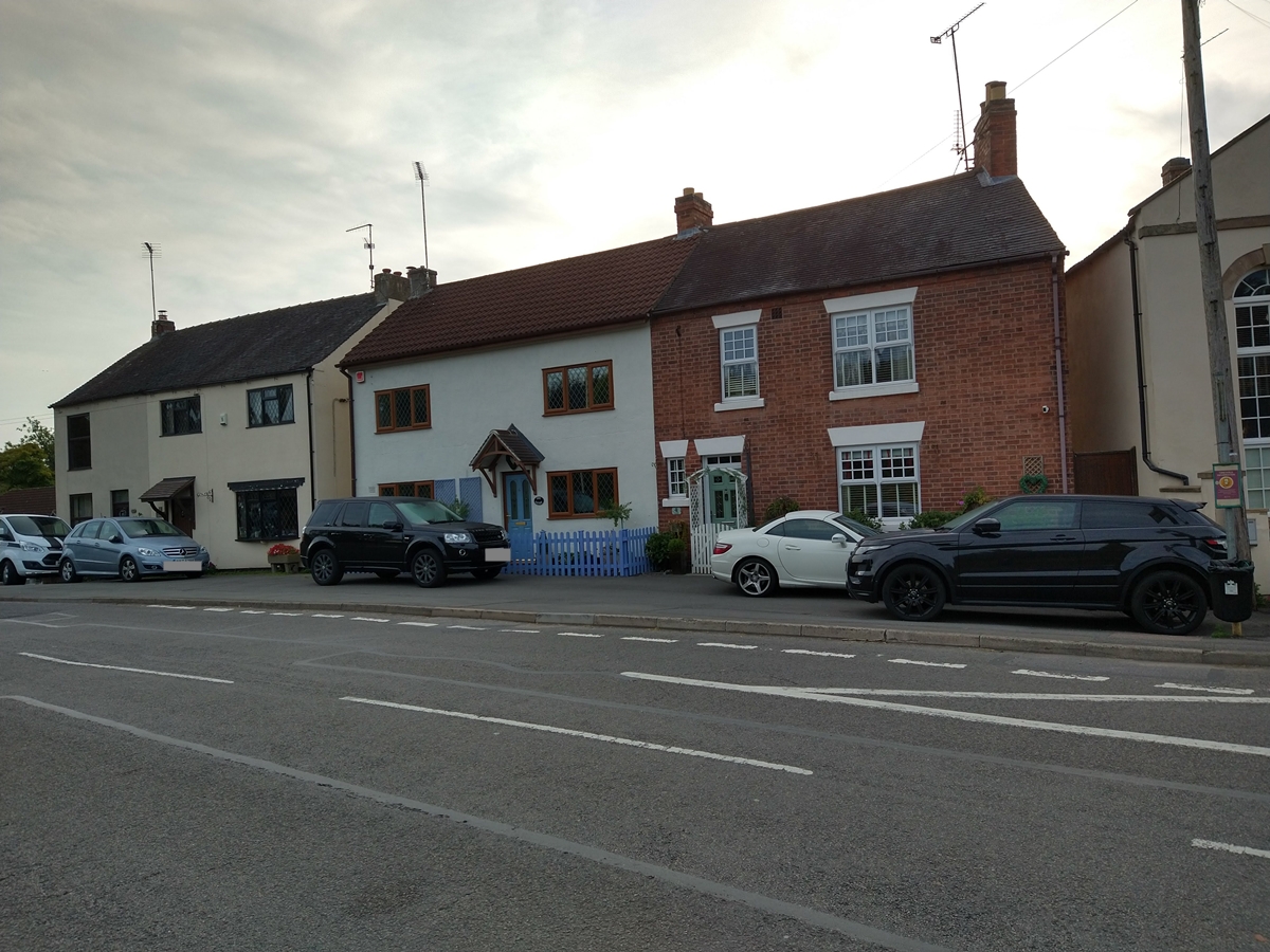 Houses next to the chapel
 Houses and bungalows on site of Willow Farm
 Centre Farm's courtyard style buildings
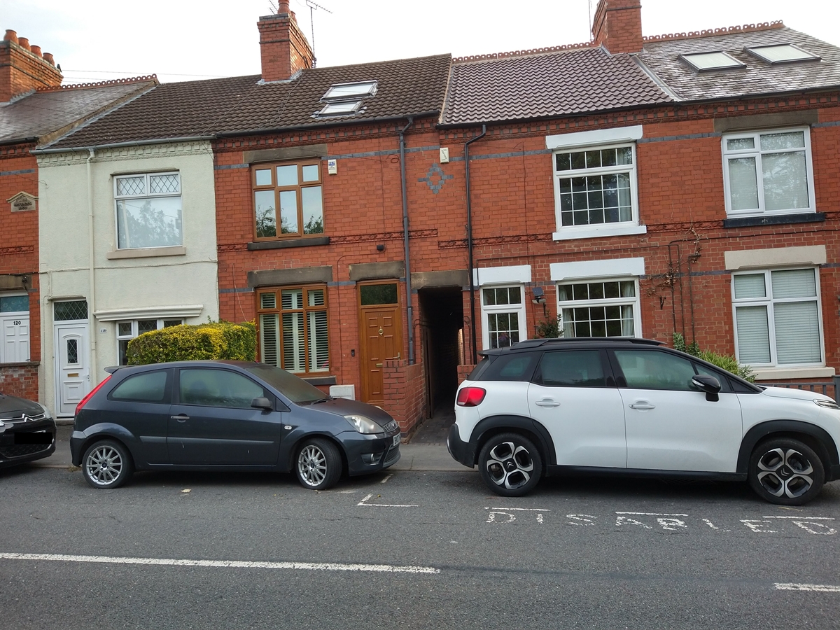
Primitive Methodist Chapel To Centre Farm – West Side
Elm Farm – Eighteenth century Elm Farm is more than 200 years old, but is no longer farmed.
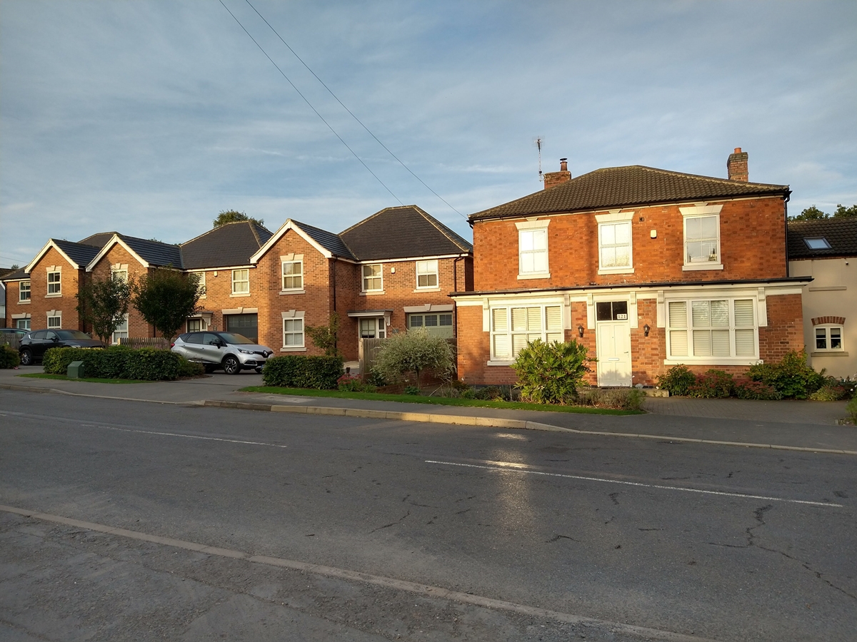
“New Houses” – Some relatively recent houses.
Three cottages – The three cottages next to the school playing field are a century or more old, read Peggy Shipman’s account under Centre Farm.
 Newer houses at the south of Main Street
 Three cottages next to school playing fields
School To Burtons Lane – East Side
Petrol Station – Local government planning departments get their fair share of moans, but they are unlikely to approve potential hazards such as a petrol station opposite a school. The petrol station closed in the early 2000s and a couple of houses now stand on the site.
Village Tap – For those of us who have grown up with ample supplies of running water it is hard to believe that Swannington did not get piped water until 1938. Wells served individual or groups of houses. The tap was often used by miners and the trough for horses.
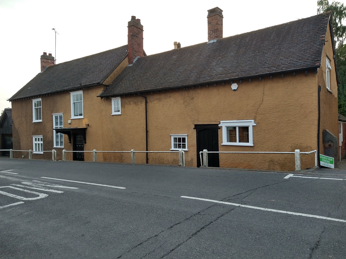
Old Tap House – The house used to provide the water supply for the village tap. The initials EMP on the wall stand for the early 18th century Quakers Edward and Priscilla Mugglestone.
Quaker Smithy – Once a Quaker Meeting House, it then became a Baptist Chapel. The Rowse family used the building as a blacksmith’s smithy. It is now a house.
Historic England Grade II – 1074353 – 01-Sep-1983 – House, early c17. Coursed squared rubble with plinth. Gable to road. 2 storeys with attic. Full listing description of the Quaker Smithy.
 Swannington School, plus the petrol station, shop and Wesleyan Chapel. Can you name the year?
 Two houses have been built on the site of the petrol station that closed in the early 2000s
 The village tap and trough was used by thirsty miners and horses
 Quaker meeting house and the Old Tap House
School To Burtons Lane – West Side
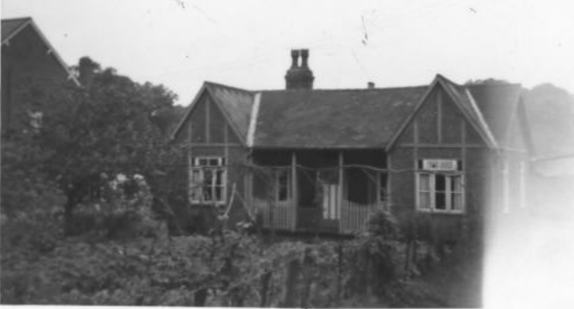
Swannington School – The school opened in 1862 and was extended with an infants school / mission hall in 1894. Read more about the building and the school’s history and class photographs.
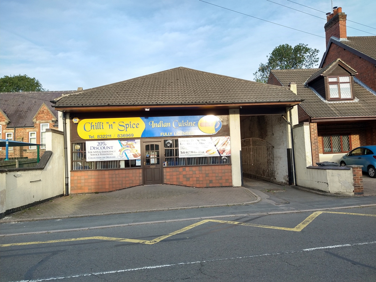
Chilli ‘n’ Spice – In 1908 Wyggeston Hospital sold some building plots north of the school. The one next to the school became the new Cooperative Society shop in 1909. The premises changed hands and at one time was Holmes butchers, then Four Counties Interiors. It is now the popular Chilli’n’Spice restaurant which achieved fame when the band Westlife sent a helicopter to transport a £1,500 takeaway to Manchester. Read more about the Swannington Cooperative Shop and the site’s history.
Centre Cottages – Built around 1909 on plots sold by Wyggeston Hospital in 1908.
Wesleyan Chapel – In 1908-9 builders Walter Moss and sons, based at The Grove, Main Street, built a replacement for the original chapel (up the jitty near the Stone House). Read more about the chapel which closed in 1998 and became a house.
Historic England Grade II – 1375728 – 23-Jul-1998 – Methodist church and attached parish room. 1909 extended c1925. Designed by Withers & Meredith. Red brick with half-timbered gables and ashlar dressings. Full listing description of the Wesleyan Chapel.
 Infants school and mission hall built 1894
 Chilli 'n' Spice provides eat in and takeaway food
 Centre Cottages between restaurant and chapel
 After 1998 closure the Wesleyan Chapel was converted into a house
 The new Wesleyan Methodist Chapel in its prime
 Wyggeston Hospital sold building plots in 1908, Swannington Cooperative Shop reopening day 1909 after relocation from Hough Hill
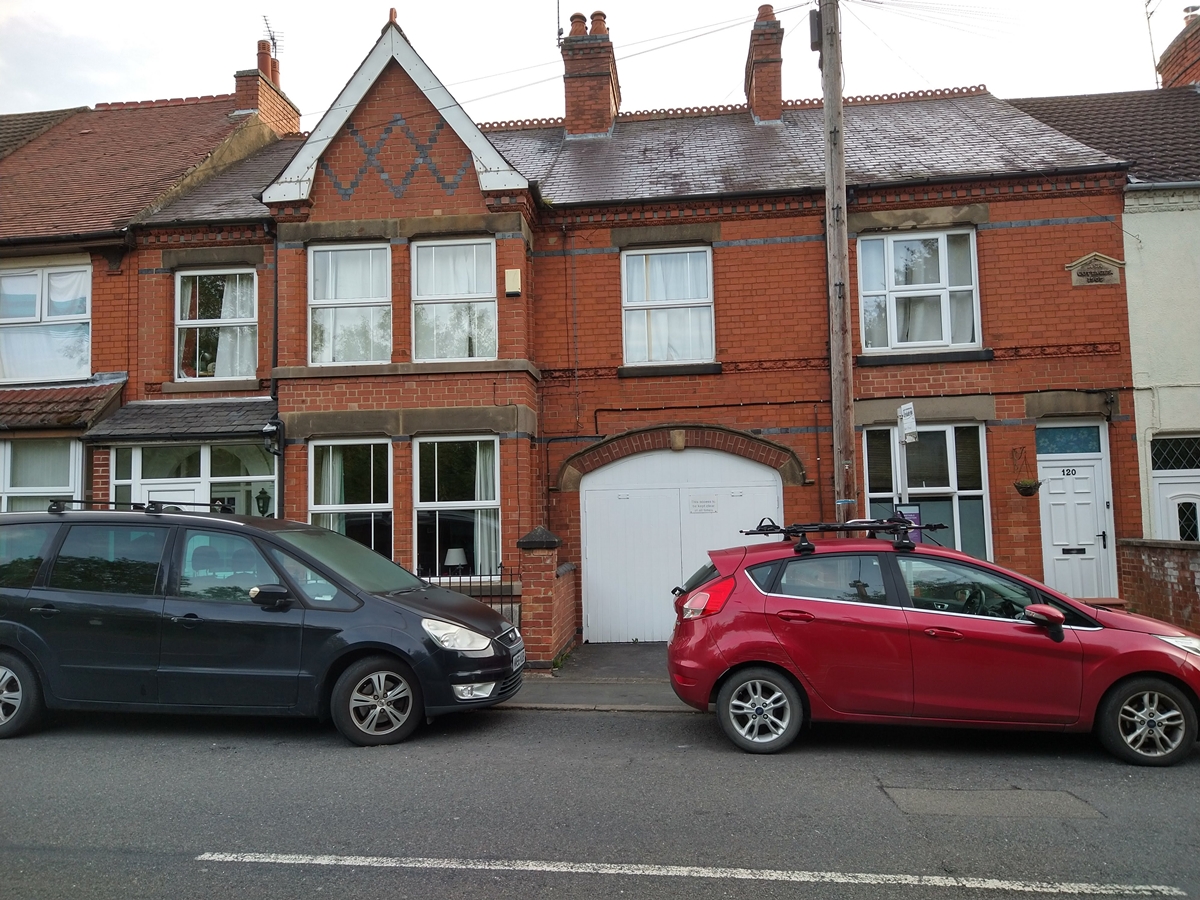
Burtons Lane to Village Hall – East Side
The house near the corner of Church Lane is shown on the 1883 map. Swannington builder, the late Keith Brooks, built a substantial brick house next to it on the site of the former Manor House barns.
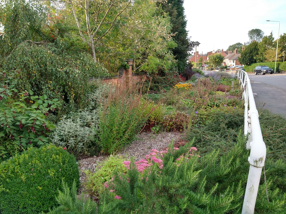
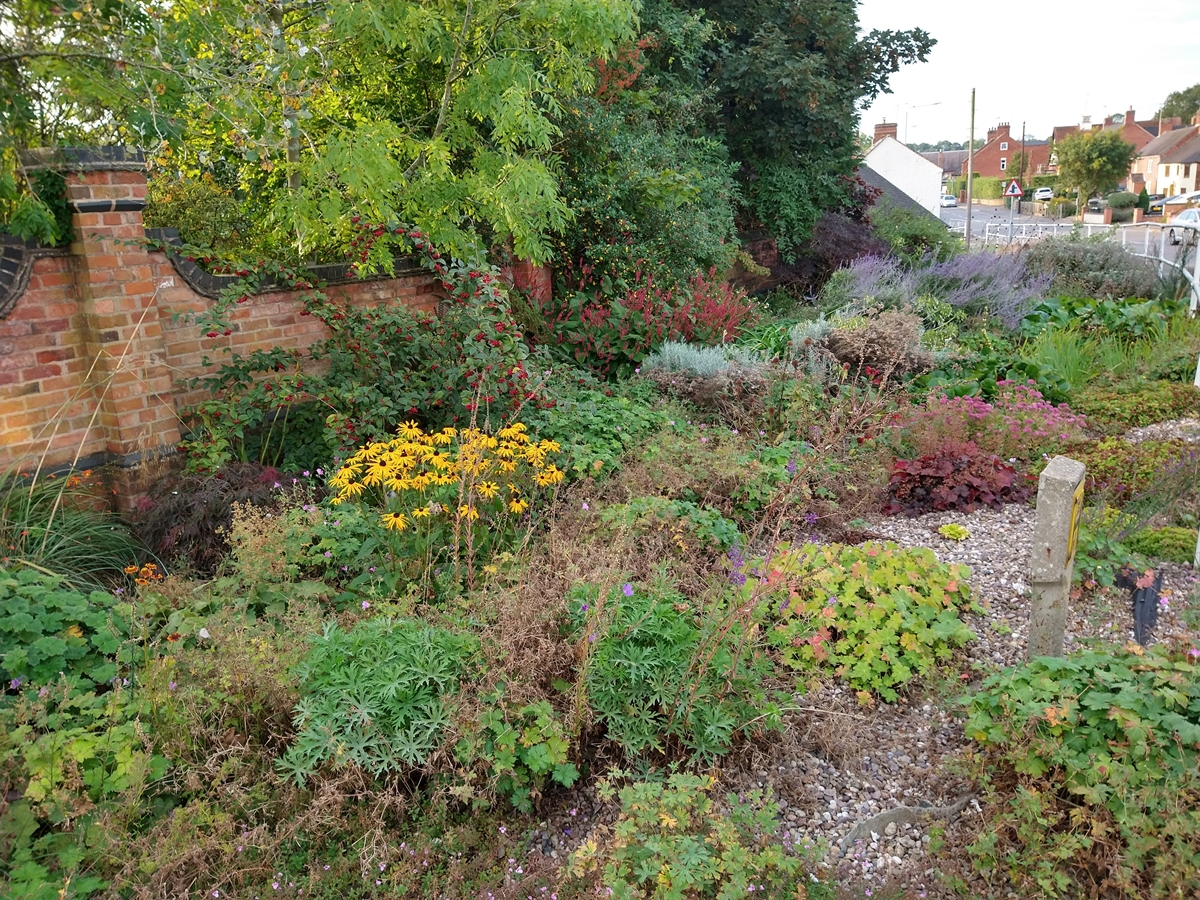
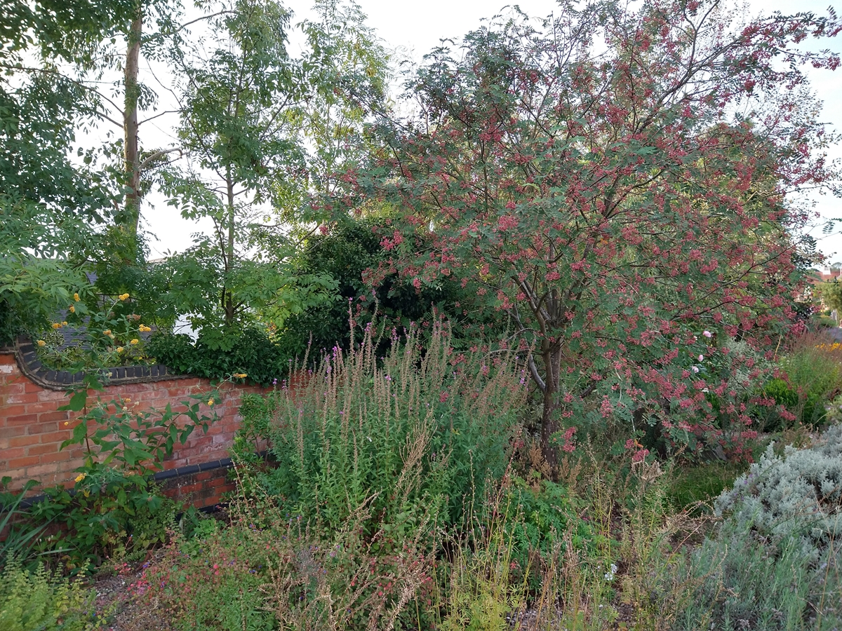
This part of Main Street used to be dominated by Manor Farm. Wyggeston Hospital used to hold the court leet there, some of the post court leet dinners were held in the Bull’s Head across the road.
The land is no longer a farm. The outbuildings were demolished in 1985 to facilitate the widening of the road. After a narrow strip of land next to the road had been derelict for 20 years, the Women’s Institute took it on in 2006 and do a wonderful job maintaining a roadside community garden for all to appreciate on the site of the former cowsheds. The rock came from Bardon quarry in 2008. Manor House is now accessed via Church Lane.
From 1833-1958 the Railway Inn stood on the corner of Main Street and Tan Yard. A brick house was built on the site in 2019-20. On the other corner with Tan Yard, the long white building used to be three cottages. It was the site of Swannington’s last sub post office and shop that closed in 2006.
 Manor Farm prior to the demolition of the outbuildings - traditionally had a Main Street address - by Peter Arnold
 Manor Farm prior to the demolition of the cow sheds. The Stone House, Belmont Terrace and the Bull's Head are on the other side of the road.
 The demolition of the cow sheds in 1985 to facilitate widening the road. The site is now the WI community garden.
 House near corner of Church Lane is on 1883 map
 Swannington builder Keith Brooks built this house
 Site of the former Railway Inn on corner of Tan Yard
 The last sub post office in Swannington
 Railway Inn
Burtons Lane to Village Hall – West Side
A hut used by the Jehovah’s Witnesses used to be on the corner of Burton’s Lane. A brick house was built on the site in the 2010s.
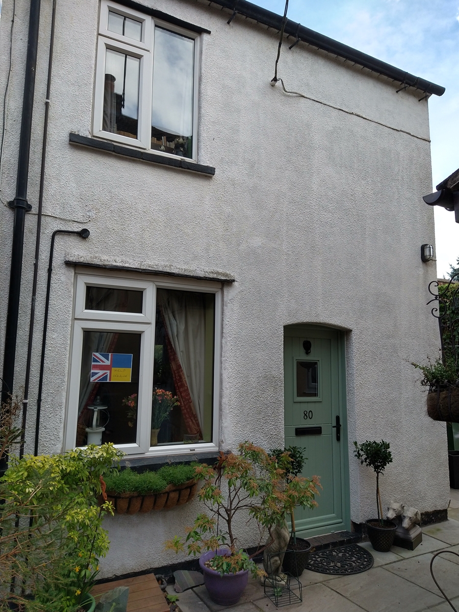
Auntie May’s Cottage – Named after May Thurman, in the 1950s she became the first lady to be elected to Swannington Parish Council. Previously the property had been a sub post office.
The Firs – At one time Thomas Atkins‘ shop. He also sold blasting powder to coal miners (hence the four powder houses around the fringes of Swannington). Thomas Atkins also owned various other properties including the Fountain Inn and Jolly Colliers on Thornborough Road.
Jitty – The jitty between The Firs and the Stone House is a public footpath that leads to the continuation of Burton’s Lane. From there there are various public footpaths leading to Limby Hall Lane and beyond. Part way up the south side of the jitty is the site of the original Wesleyan Chapel that was replaced in 1909.
Stone House – This is one of the oldest buildings in Swannington, possibly dating from 1633. At various times it has been in multiple occupation. There is a suggestion that it may once have been occupied by a representative of Wyggeston Hospital who owned the manor of Swannington, the now bricked up side windows would have provided a view of the village in both directions.
- Historic England Grade II – 1361235 – 06-Dec-1952 – Large house …. Early c17 …. 3 storeys with attic. Full listing description of The Stone House.
- Read some aspects of its long history
- List of occupants of the Stone House 1881-1939
Bull’s Head and Belmont Terrace – 71 Main Street is Bulls Head House, the former Bulls Head Inn (was once operated by John George Hough the son of John Hough who bought Thringstone Smock Mill (now Hough Mill) in 1878. Belmont Terrace or Bull’s Row are the terraced cottages to the left of the Bull’s Head, including the arch to the former abattoir and butcher’s shop at the rear. During the late 19th and early 20th centuries most of the terrace was occupied by the Johnson family
In 1996 several houses were evacuated while a 25lb second world war bomb was safely detonated in a field behind the houses to the right of the Bull’s Head.
 House on corner of Burtons Lane
 Auntie May's Cottage (left)
 The Firs 2020
 The Firs - Thomas Atkins shop
 Stone House early 20th century
 The Stone House, December 2012 - by Bill Pemberton
 The Bull's Head when an inn
 Left Stone House, then Belmont Terrace / Bull Row, then the Bull's Head 2010
Village Hall to Limby Hall Lane – East Side
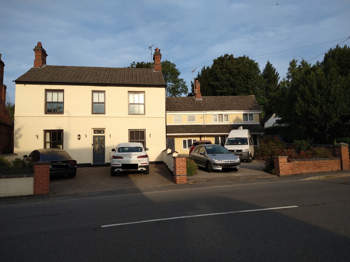
The Grove – The large orange/brown house opposite the village hall, with white railings erected after cars had crashed into the building. Unusual in having twice been owned by two sets of members of the same family. The Moss family who built the Wesleyan Chapel and Coalville clocktower moved there between 1901 and 1905.
Historic England Grade II – 1074352 – 01-Sep-1983 – House, c17 or earlier, extensively altered at successive later dates, and with facade of c1900. Full listing description of The Grove.
Swannington House Field – Houses on the field between The Grove and the former Swannington House.
Site of Swannington House – Former occupants:
- Eliza Jane Potter – Eliza Jane Potter (nee Knight) was the widow of John Potter of Talbot Farm she made her will while living in Swannington House, but died in Middlesex in 1890.
- William Checkland – Owner of Coleorton No 3 Colliery, known as the Bug and Wink, now Coleorton Wood.
- 1900-1946 Lady Beaumont – The dowager Lady Beaumont lived in Swannington House for more than 40 years until her death in 1946. Read more about Census 1911 – The Inhabitants of Swannington House
- 1946-? Arthur George Toon – The house was bought by butcher Arthur George Toon whose shop was near the Station Inn. The house was demolished due to subsidence and new houses built on the site in 1985.
Swannington Heritage Trust is always keen to add photographs and documents to its archive and is particularly seeking material relating to Swannington House and Lady Beaumont. Please contact the Trust if you can assist.
Lady Beaumont’s Houses – Lady Beaumont owed the two houses next to Swannington House. In 1911 the nearest house was occupied by her gardener Charles Thomas Gray, by 1939 her gardener was Thomas J Shipley. In 1939 Lady Beaumont also owned the next house that was occupied by Ernie Yates her chauffeur and his wife Annie (known as Nurse Yates). Ernie attended the 1982 Swannington Festival that led to the formation of Swannington Heritage Trust in 1984.
Hidden House – Keen eyed residents and walkers will be aware of the hidden house that is secreted behind the others in the row. Yet many long term residents and motorists who regularly drive through the village will be unaware of the property. It has an interesting history.
Ivanhoe House – In 1911 Charles Atkins (brother of shop owner Thomas) lived in the house at the end of the row.
Bottom Of Incline
Western end of the Leicester and Swannington Railway – The 1830 Act of Parliament states that the railway terminates at the Hinckley Road in Swannington. It is sad that Robert Stephenson’s 1832 railway that reached Swannington has such an inauspicious end, it would be great if the village could make a feature of the site. Track for the Califat tramway went across the road to a weighbridge next to the Fountain Inn.
Railway track once ran along what is now a service road for the residents at the bottom of the Incline.
Incline Bungalow and Caithness House
The 1923 map does not show any houses at the bottom of the Incline. The 1930 and 1931 electoral register lists Ernest Harold and Mary Elizabeth Walker at Incline Bungalow, their home was probably built for them. They had been living at Station Hill the year before. Ernest Harold had been a private in the machine gun corps during the First World War, being discharged on the 8th August 1919 with a disability.
They were still there at the time of the 1939 register, despite his disability Ernest Harold was a coal miner, working underground as a shifter. Mary Elizabeth undertook the usual unpaid domestic duties. Their son Reginald Walker was a bricklayer and daughter Ethel Walker a shorthand typist. Ethel married painter and decorator Harry William Walford from Colchester in 1946.
Their other daughter, another Mary Elizabeth Walker had married coal miner George Edwin Marriott in 1934 and they had children born in 1939 and 1942. George Edwin was a blacksmith’s striker. George Edwin and his family lived next to the Incline Bungalow in Caithness House. Cyclist George Edwin was killed by a car in Coleorton on the 8th February 1958.
Note – Swannington Heritage Trust does not own the land at the bottom of the Incline and there is no public access over the private land between the service road and the Trust’s property. Walkers should access the permissive path along the Incline (open 6am to midnight) via Church Lane Bridge or Spring Lane.
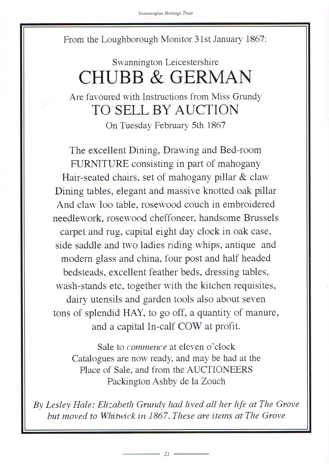 January 1867 sale of Elizabeth Grundy's furniture at The Grove
 The Grove opposite the village hall
 Built on Swannington House field
 Built on site of Swannington House approx 1985
 The rear of Swannington House
 Painting of the rear of Swannington House by Emma Morley
 Formerly owned by Lady Beaumont
 The "hidden house" behind the others
 Ivanhoe House (left) next to the end of the Leicester and Swannington Railway
 Incline Bungalow - from Peter Walford
 Rear Of Incline Bungalow - from Peter Walford
 The front of the Hidden House only has windows opposite the access alley
Piano Row
The Main Street cottages known as Piano Row were built during the first decade of the 20th century. Families generally lived in the back room and preserved the front parlour for special occasions and guests. It is believed that once one family proudly displayed a piano in their parlour (the piano would have been visible form the street), “every house proud housewife” was keen to likewise display a piano in their front room, probably regardless of whether anyone could play the instrument!
The gardens of the Piano Row houses back on to the Coleorton Railway.
Vale Cottages – four cottages
Ash Cottages 1905 – six cottages including Gertrude Irons’ shop and Robinsons Undertakers.
Brook Cottages 1907 – six cottages (the name Sleepy Hollow also used)
Woodbine Villas 1905 – two cottages
Oakdene Cottages 1906 – two cottages
Rosedene Cottages – two cottages
 Piano Row
 Piano Row - Ash Cottages - formerly Mrs Irons shop (light colour)
 Piano Row - Ash Cottages - formerly Robinsons Undertakers
Village Hall to Limby Hall Lane – West Side
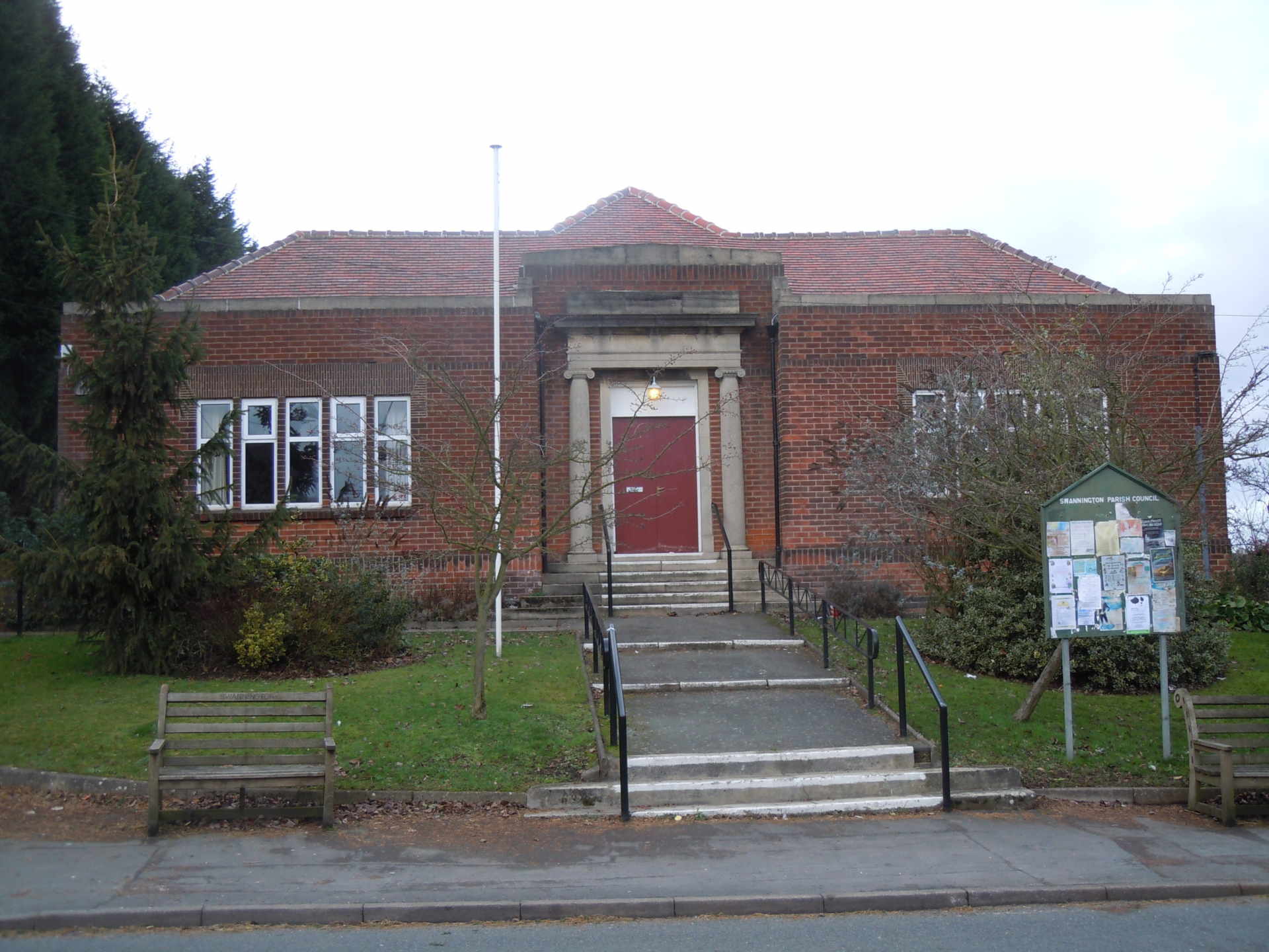
Village Hall – The Miners’ Welfare Institute was built in the 1930s on land donated by Wyggeston Hospital. The Trust archive has a fabulous poem about the lengthy process. In 1949 Swannington Parish Council took over the running of the building. The council have extended the building adding toilets and a car park.
Public Footpath – The public footpath leads to Limby Hall Lane, from which there are many options including the public footpath leading to the Gorse Field, Hough Mill and Califat Spinney.
Houghs’ Cottages – At various times in the 1930s and 1940s members of the Hough family lived in these cottages (to the right of the village hall) that were built on plots sold by Wyggeston Hospital in 1908.
Trinders – Since the 1962 map several houses and bungalows have been built near Houghs’ Cottages. Trinders in named after Henry Trinder who farmed in the area during the 19th century. During the mid 19th century the Marquis of Hastings, as Lord of the Manor of Whitwick, claimed the rights to the coal measures under Swannington Common. Henry Trinder had previously been the head coachman to the father of the Marquis and in 1863 attested that the Marquis had confided the claim was without merit. Wyggeston Hospital became more assertive in promoting its manorial rights.
Fountain Inn – Originally a coal manager’s house with a weighbridge and situated opposite the western end of Robert Stephenson’s Leicester and Swannington railway. The Fountain Inn closed in 2013 and was converted back into a house, three houses were built on the former car park.
Brook House – Built at the end of the 19th century and continually in the occupation of the Atkins / Richards / Smith family ever since. In 1901 and 1911 the inhabitants were gunpowder cartridge makers working in the powder houses on the outskirts of Swannington.
Califat Tramway – The 1850s horse drawn tramway took coal from the Coleorton No 2 coal mine, known as Califat, to the Leicester and Swannington railway. The Califat tramway ran parallel to St George’s Hill and Main Street then between Brook House and The Fountain Inn before crossing Main Street. Opposite Piano Row, look carefully and the remains of the tramway embankment can be seen.
 Village Hall
 Village Hall
 Hough's Cottages
 Trinders named after farmer Henry Trinder
 The Fountain Inn
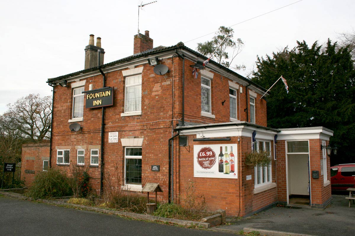 The Fountain Inn closed 2013
 Fountain House and new houses on former Fountain Inn car park
 Brook House owned by Atkins and Smith family for over a century